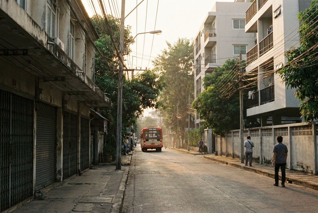
Sukhumvit Soi 55 runs almost three kilometres north from the train line to the canal. Here is how the long walk unfolds, and how to shorten it when the heat wins.
- From the BTS
- Thong Lo station, then north
- Best time of day
- Early morning
- Getting there
- BTS Sukhumvit Line to Thong Lo
- Bring
- Water, a hat, small notes, comfortable shoes
Before nine the pavement is still cool and the shutters are half up. By noon the concrete holds the heat, and the shady side of the soi changes with the hour.
Thong Lo is the everyday name for Sukhumvit Soi 55, and you will also see it written Thonglor on signs, maps and taxi screens. It is one long, mostly straight road that leaves Sukhumvit Road at the BTS station and heads north until it meets Phetchaburi Road, with the Khlong Saen Saep canal just beyond. The full length is about 2.5 to 3 kilometres. That is a fair walk in Bangkok heat, but it is also the best way to understand how the soi is put together.
Starting under the train line
Thong Lo station sits on the BTS Sukhumvit Line between Phrom Phong to the west and Ekkamai to the east. Take the exit on the north side of Sukhumvit Road and you are at the mouth of the soi. This first stretch is the busiest for traffic: cars turning in from the main road, taxis stopping to drop people off, and a cluster of motorbike taxis waiting at the corner.
The pavements here are narrow in places and broken by driveways, steps and the occasional pole planted in the middle. Walk with your eyes a little ahead of your feet. Raised kerbs, missing tiles and drain covers are part of every Bangkok footpath, and Thong Lo is no exception.
How the side sois are numbered
Off the main road run dozens of smaller lanes, each called Thong Lo followed by a number. The numbers climb as you head north, with odd numbers on one side and even on the other, so Thong Lo 10 and Thong Lo 11 are roughly opposite each other. This makes the soi easy to navigate once you know the system. Ask a taxi or a motorbike rider for a side soi number and they will know where to go.
Some of these lanes are short dead ends lined with townhouses and condominium gates. Others are longer and wind through to neighbouring streets. A few connect east toward the parallel road, which is how you can cross on foot to Ekkamai, the next soi east without returning to Sukhumvit Road. Not every lane goes through, so be ready to double back.
The middle stretch
Past the first few side sois, the road settles into a pattern you will see for the next couple of kilometres: older shophouses with metal shutters, newer mid-rise buildings set back behind parking, small offices, clinics, and residential towers. Food carts appear and disappear through the day, setting up on corners and in the gaps between buildings. If you want to understand how they work, read how eating works on a Bangkok soi before you go hungry halfway up.
Traffic in the middle stretch flows both ways and can be heavy at rush hour, but it moves slowly enough that the walk itself feels calm. Evenings are another matter: the soi becomes a dining and nightlife street, and cars queue for parking at the busier spots.
Walk with your eyes a little ahead of your feet.
Riding instead of walking
Also on the blog: The canal boat from Thong Lo pier
Plenty of residents never walk the whole thing, and you do not have to either. Two kinds of local transport run up and down the soi.
The soi buses
Small red buses work the length of Thong Lo, picking up and dropping off along the way. You flag one down from the kerb, climb in, and press the bell or call out when you want to get off.
Motorbike taxis
Riders in numbered vests wait at stands near the BTS exit and at the mouths of busier side sois. Tell the rider where you want to go before you get on and agree on the fare. Hold on, keep your knees in, and take the helmet if one is offered. Motorbike taxis are fast in traffic, but they also squeeze through gaps you might prefer they did not.
Crossing safely
Traffic in Thailand drives on the left, so the first lane of cars comes from your right when you step off the kerb. Pedestrian crossings exist, but drivers do not always stop for them. The safest approach is patient: wait for a real gap, cross with other people when you can, and watch for motorbikes, which sometimes ride against the flow close to the kerb or come along the footpath itself.
At night, wear something light and avoid crossing between parked cars. On the busiest junctions, a traffic officer may wave cars through by hand. Follow their signals rather than the lights.
Shade, heat and the top of the soi
Thong Lo runs roughly north to south, which means the sun is on one side in the morning and the other in the afternoon. Shade comes from awnings, trees outside older compounds, and the tall buildings, and it shifts as the day goes on. Early morning is the best time to walk the full length. You will see the soi waking up, with shutters rising and carts arriving, and the heat is still gentle.
The northern end feels more residential and a little quieter. When you reach Phetchaburi Road, the soi ends. The canal lies just beyond, and a short walk takes you to the Thong Lo pier on Khlong Saen Saep, where the express boats run west toward the old city. Do this walk in the cool months if you can; the seasons on the soi make a big difference to how far you want to go on foot.
Along the way, small spirit houses stand in front of many buildings, raised on posts and decorated with garlands, drinks and small figures. Walk around them rather than stepping over offerings on the ground, and do not touch them. You may also pass monks on their morning alms round, walking quietly in single file. Step aside to let them pass.
Coming back, you have choices. Walk the whole way again on the other side of the road to see what you missed. Wave down a red soi bus. Or take a motorbike taxi to the station and be there in minutes.